
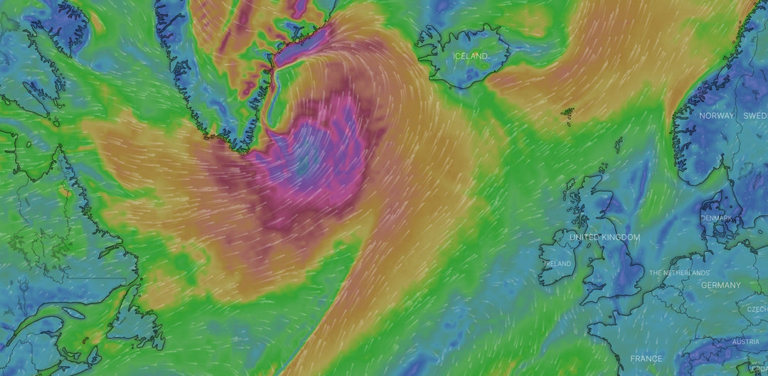
Forecast for Friday 24th October through to Monday 27th October
Temperatures have definitely dropped in the last week bringing more challenging conditions - check out our selection of boots and gloves if you are starting to feel the chill. Dublin will see one day of surf on Saturday with both Saturday and Sunday offering wind. Donegal bay will have surf all weekend and plenty of wind. It will take a bit of moving around to find the right wind direction for surf or wind sports but plenty of potential.
East Coast – Dublin Area
Surf Forecast
-
Friday: No surf today.
-
Saturday: Forecast gives a 1.8 metre NNE swell at 7 seconds with WNW winds. This should give some really good surf conditions along the East Coast.
-
Sunday: Not much chance of surf today.
-
Monday: Small chance of waves north or south of Dublin but swell looks too small to get into Dublin bay.
Wind Forecast
-
Friday: Wind is a bit all over the place today. Worth waiting for tomorrow if you can.
-
Saturday: Good forecast for today with WNW wind in the 13-23 knot range at 9am building to 16-27 knots by 11am and staying in and around that then for the rest of the day.
-
Sunday: Good wind again today with the best of it coming between 1pm and 6pm. Wind will peak at 3pm at 18-31 knots from the west.
-
Monday: The wind drops off today. There should be enough for foils or big kit in the morning with 11-18 knots from the west.
West Coast – Donegal Bay
Surf Forecast
-
Friday: 3 metre north west swell at 10 seconds with winds initially from the NNE before turning fully north at around 3pm. There will definitely be clean surf if you know where to look.
-
Saturday: 3.2 metre NNW swell at 10 seconds at 9am. There will be waves all day but the wind will be strong from the NNW giving limited options to find clean waves.
-
Sunday: A 2.5 metre north west swell at 8 seconds will build slightly through the day. The winds will be WSW at 9am giving the best chance of offshore conditions but from 1pm they turn into the WNW and clean surf will be hard to find.
-
Monday: A 3.9 metre north west swell at 12 seconds at 9am will drop off slowly through the day. Winds will be from the WSW for much of the day giving offshore conditions and a number of spots around Donegal bay.
Wind Forecast
-
Friday: 15-22 knots from the NNE for much of the day. This will give fun conditions.
-
Saturday: Much stronger wind today in the 22-32 knot range from the NNW. Great forecast for wind sports.
-
Sunday: The wind will be from the WSW in the morning before turning into the WNW from 1pm. Starting off in the 19-29 knot range it will increase to 23-34 knots by mid morning and increase again to 25-36 knots from about 1pm. Solid wind forecast!
-
Monday: The wind will blow from the WNW first thing in the morning but switch into the WSW from around 11am. The best of the wind will be in the afternoon. 13-18 knots at 1pm will increase to 16-22 knots by 3pm and continue to increase into the dark. Good conditions again today for wind sports.
NB: This is all subject to change at short notice. This being Ireland weather systems are volatile and a forecast made even the night before can change over night. Hopefully this forecast blog can give a good prediction of what will happen in the days ahead so you can plan the days you look to go on the water but it is always a good idea to check more location specific forecasting models before you go both to know what equipment to bring and for safety.
Abbreviations:
SSE – South South East
SSW – South South West
NNE – North North East
NNW – North North West
ESE – East South East
ENE – East North East
WSW – West South West
WNW – West North West


Leave a comment